
Remote Sensing in Service of Soil Health
Remote sensing: seeing the Earth differently
Imagine analyzing the chemical composition of a soil from a satellite hundreds of kilometers above the surface. That is exactly what remote sensing makes possible: satellites capture the electromagnetic radiation reflected or emitted by the Earth's surface and use it to infer information about its nature.
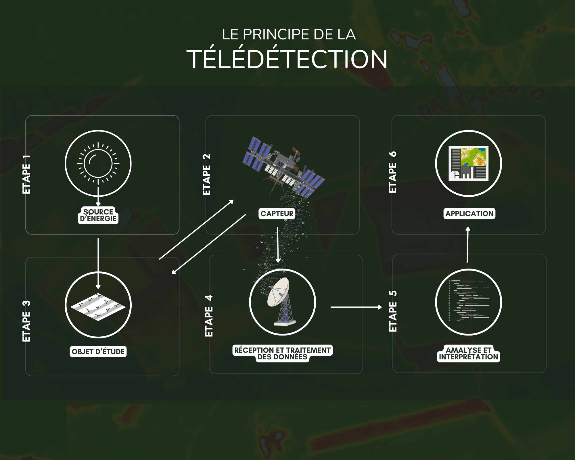
Satellites such as Sentinel-2 or Landsat carry sensors capable of observing light in many forms, far beyond what the human eye can see. Once processed, this data becomes a true X-ray of our environment.
Soil and its carbon: why does it matter?
Soil organic carbon (SOC) is one of our planet's most precious resources. It results from the decomposition of organic matter (leaves, roots, micro-organisms) and plays a fundamental role in:
- Agricultural fertility: a carbon-rich soil is a living, productive soil;
- Climate regulation: soils store roughly 2 to 3 times more carbon than the atmosphere;
- Water retention: carbon improves soil structure and its ability to hold water;
- Underground biodiversity: it feeds billions of essential micro-organisms.
Measuring this carbon at scale is therefore a major scientific, agricultural, and climate challenge.
How does light "reveal" the soil?
Every material reflects light in its own way, a property known as its spectral signature. Soil organic carbon strongly absorbs certain wavelengths, particularly in the near-infrared (NIR) and short-wave infrared (SWIR). A soil rich in organic matter therefore appears darker and displays a specific reflectance that satellite sensors can identify.
Put simply: the richer a soil is in organic carbon, the more light it absorbs and the less it reflects, much like a black fabric compared to a white one under the sun.
Spectral indices: turning light into data
To exploit these spectral signatures, scientists compute spectral indices, mathematical formulas that combine several wavelength bands to highlight a specific property of the soil or vegetation.
NDVI: the flagship index
NDVI (Normalized Difference Vegetation Index) is the best-known index. Its formula is simple:
NDVI = (NIR − Red) / (NIR + Red)
It measures vegetation vigor by exploiting the fact that healthy plants strongly absorb red light (for photosynthesis) and strongly reflect near-infrared.
| NDVI value | Interpretation |
|---|---|
| < 0.1 | Bare soil, rock, water |
| 0.1 – 0.3 | Sparse or stressed vegetation |
| 0.3 – 0.6 | Moderate vegetation |
| > 0.6 | Dense, healthy vegetation |
But what is the link to soil carbon?
The link is indirect but powerful. Dense, healthy vegetation:
- Produces more biomass (leaves, roots);
- This biomass decomposes and integrates into the soil;
- It feeds the organic carbon stock.
As a result, a high NDVI over several years is often correlated with a soil richer in carbon. Scientists use NDVI time series to model how carbon evolves over time.
Other complementary indices
NDVI is not alone. Other indices refine the analysis:
- BSI (Bare Soil Index): detects bare soils, where direct carbon measurement is possible;
- NDMI (Normalized Difference Moisture Index): assesses moisture, linked to biological activity;
- EVI (Enhanced Vegetation Index): an improved version of NDVI, less saturated over very dense areas;
- SWIR-based indices: particularly sensitive to soil organic matter.
Conclusion: a tool in service of the climate
Remote sensing through spectral indices offers a unique window onto soil organic carbon. By combining the power of satellites, the rigor of field analyses, and modern modeling tools, scientists can now map and track carbon evolution at regional or global scales.
In the fight against climate change, these tools are becoming indispensable for evaluating sustainable agricultural practices, monitoring land degradation, and quantifying the carbon sequestration potential of soils, one of the most powerful natural levers we have.
"Soils are the silent mirror of our relationship with the Earth. Remote sensing finally gives us the eyes to read them."